Wednesday, November 30, 2011

My Greatest Christmas Present Ever

What a dizzy person looks like who sleeps poorly
This photo shows me with my Alvarez acoustic guitar, which my parents gave to me as a Christmas present in 1975; thus I have had it for nearly 36 years.  My mother bought it for $120 (along with a second Alvarez for my sister) at a small music store on Eubank Blvd., north of Constitution Ave., called "Mr. Music," which went out of business shortly thereafter.  

I haven't played the Alvarez much in recent years due to my fascination with the electric guitar -- which resulted primarily from the fact that extremely versatile, relatively inexpensive guitar amplifiers (like my Line 6 "Spider" amplifiers) are on the market now.  However, last week I put a new set of strings on it and sort of "re-discovered" it, finger-picking old tunes like Roberto Carlos's "La paz de tu sonrisa," Christopher Cross's "Think of Laura," Fleetwood Mac's "Landslide," and Bread's "Diary."  At times I've considered buying a new, more-expensive acoustic guitar, but there simply is no need; the Alvarez has taken a beating through the years (including the extremely poor job I did years ago of replacing the tuners), but it still plays and sounds nice.  It was an "entry level" guitar -- note the adjustable bridge -- but it was always much, much more.
When I think about how long I've had the Alvarez, it occurs to me that it is the greatest Christmas present I've ever received.  How many people ever receive a gift that still brings them joy, and has practical utility, three or four decades after the fact?  I bless my mother for her kindness and generosity in buying it for me.

Wednesday, November 23, 2011

Hike to Rincon Ridge via Piedra Lisa Spring Trail

The Knife Edge of the Shield
The northern Sandias from the Rincon

View of rock formations from the Piedra Lisa Spring Trail
I'm still trying to hike on Sunday afternoons after church. Last Sunday, November 20, I hiked up the Piedra Lisa Spring Trail to Rincon Ridge, a 4-plus-mile hike (round-trip) that I'd wanted to do for some time but had put off due to (a) the long-ish drive required to get there, and (b) the lamentable $3.00 day-use fee that the USFS imposes on people parking at any of its trailheads.  (I remember when the USFS started charging what it originally called a "courtesy" fee [what a joke!]; the ranger I first spoke to about it told me the USFS was just "trying it out," but, alas, government regulation and taxation only ever seem to ratchet in one direction.)  Anyway, it was a great hike for me -- I loved the scenery and did passably well on the uphill leg; however, I've got to remember to take my trekking poles even on these shorter hikes, as the pounding I took on the way back down caused my lower back and hips to ache horribly.  The first picture above shows the "Knife Edge" of the Shield, the largest single rock face in the Sandias. (The "Knife Edge" is an increasingly popular route for thrill-seekers -- it's "Class 4" in rock-climbing terms but extremely exposed -- and several people have uploaded videos to Youtube showing some exciting jumps.)  The second picture is the view north from the Rincon, showing an aspect of the Sandias that is invisible from Albuquerque.  The last picture shows the "Needle," a large pinnacle, on the left, and the "Tombstone," a small formation that I climbed several times with Rod Williamson (most recently in 2002), in the middle.

The route

Saturday, November 19, 2011

Trip to Heber/Overgaard, AZ (Nov. 11-13, 2011)

At Cardo's in Payson
In our suite at the Worldmark resort


Mogollon Rim
Mike and Judy on the Rim

Looking at clouds from both sides now
Playing games in the suite

Dorine and I in the living room
Hot-tubbing in 40-degree weather
Mike taking panoramic pictures
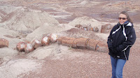
Dorine at the Petrified Forest
Painted Desert, AZ
Dorine and I went to Arizona last weekend with Mike and Judy for our annual "anniversary" trip, which took place earlier than usual this year owing to family matters due to arise in the first half of December.  Mike and Judy are members of "Worldmark by Wyndham" (which is described on its website as a "flexible vacation ownership program"), and we were able to get a large suite at the resort in Overgaard, AZ (adjacent to Heber) for a really good rate.  Our trips with Mike and Judy are always enjoyable, largely because we purposely don't do much besides kick back and relax -- and we always eat well.  On this trip we drove into Payson on Saturday for gasoline (staying for lunch), and then we drove along the Mogollon Rim, marveling at the scenery.  On Sunday, we drove through the Petrified Forest and Painted Desert on the way home.

Sunday, November 6, 2011

Hike up Long Canyon, 11/6/11

Me in Long Canyon, 11/6/11
Dorine and I took a short hike today up what I believe is called Long Canyon, which I'd never, in all my years of hiking in the Sandia Mountains, visited before.  The canyon is accessed at the southeast corner of the Glenwood Hills subdivision, which itself is located at the far eastern end of Montgomery Blvd.  As it happens, Long Canyon is a pretty cool place, at least the lower part that we saw.  I now want to go back and hike up the entire canyon to its head at/near the "Whitewash" Trail.  The topo map (below) shows the canyon becoming quite steep near the top; however, it looks manageable, assuming there's a recognizable trail up that high.  I'm not quite sure why Mike Coltrin makes no mention of Long Canyon in his hiking guide; I wondered if it might be private land, but the topo map shows the wilderness boundary (dotted line) passing just beyond the existing subdivision.

[Update 11/8/11: I happened to be e-mailing Coltrin yesterday about a work-related matter -- he, too, works at Sandia National Laboratories -- and, in an aside, I asked him why there was no mention of Long Canyon in his hiking guide.  His response was simply that he omitted a lot of what he referred to as "user" trails from the book (especially ones that follow streambeds, which he says he avoids for aesthetic reasons), and that he didn't want casual hikers to get lost on unofficial, primitive trails.  I'm not sure I buy that 100%, since (a) Long Canyon has such easy access, and (b) his book references many other primitive trails that would be infinitely easier to get lost on, and where it would be a much more-serious matter to be lost (e.g., Chimney Canyon).  I can't help thinking that a combination of parties -- the USFS, the City of Albuquerque, the Glenwood Hills subdivision, the residents whose houses one has to walk past to get to the canyon, and perhaps even Coltrin and his publisher -- have collectively made the decision not to publicize Long Canyon for the express purpose of minimizing vehicular traffic and hiker impact in the area.  I'm sure they'd much rather steer hikers north to the Embudito Trail (see topo map).]
The routes of my two hikes up Long Canyon
[Update 11/28/11: Yesterday afternoon I went back up Long Canyon, this time by myself, and hiked/scrambled all the way up to the Whitewash Trail.  The last half-mile or so turned out to be a bit of an ordeal -- steep, rocky, loose, bushy, cactus-y, and not much of a trail -- and immediately upon reaching a real trail, I decided not to go back down the same way.  I essentially had a choice, then, between hiking up to Oso Pass, and then down the Embudito Trail, or simply going down the Whitewash Trail; lacking a lot of daylight, I chose to do the latter.  So I sat down, drank a bottled water, ate a granola bar, called Dorine to tell her I'd need to be picked up later (and then taken back to where I'd parked my truck), and then set out down the trail.  Unfortunately, I got off the bottom part of the Whitewash Trail (there being numerous "trails" in them thar hills), and rather than back-track, I kept going down, finally having to pick and slide my way down a boulder-strewn canyon and ending up behind the flood-control dam on Menaul south of the "Whitewash Trail" parking area.  Thus the last half-mile of the descent was almost as bad as the upper part of Long Canyon, and it became clear to me that I need to start going "shorter and easier" on my Sunday-afternoon hikes or else I'm going to burn myself out.  Anyway, below are a couple of photos of Long Canyon, taken from the Whitewash Trail; the first shows the lower part of the canyon, and the second shows the upper portion where I came up -- my path roughly corresponded with where the shadow line falls here.]
Long Canyon, 11/27/11
The upper part of Long Canyon