 |
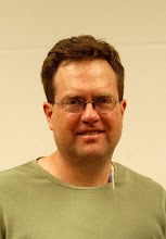
| Me in Long Canyon, 11/6/11 |
Dorine and I took a short hike today up what I believe is called Long Canyon, which I'd never, in all my years of hiking in the Sandia Mountains, visited before. The canyon is accessed at the southeast corner of the Glenwood Hills subdivision, which itself is located at the far eastern end of Montgomery Blvd. As it happens, Long Canyon is a pretty cool place, at least the lower part that we saw. I now want to go back and hike up the entire canyon to its head at/near the "Whitewash" Trail. The topo map (below) shows the canyon becoming quite steep near the top; however, it looks manageable, assuming there's a recognizable trail up that high. I'm not quite sure why Mike Coltrin makes no mention of Long Canyon in his hiking guide; I wondered if it might be private land, but the topo map shows the wilderness boundary (dotted line) passing just beyond the existing subdivision.
[Update 11/8/11: I happened to be e-mailing Coltrin yesterday about a work-related matter -- he, too, works at Sandia National Laboratories -- and, in an aside, I asked him why there was no mention of Long Canyon in his hiking guide. His response was simply that he omitted a lot of what he referred to as "user" trails from the book (especially ones that follow streambeds, which he says he avoids for aesthetic reasons), and that he didn't want casual hikers to get lost on unofficial, primitive trails. I'm not sure I buy that 100%, since (a) Long Canyon has such easy access, and (b) his book references many other primitive trails that would be infinitely easier to get lost on, and where it would be a much more-serious matter to be lost (e.g., Chimney Canyon). I can't help thinking that a combination of parties -- the USFS, the City of Albuquerque, the Glenwood Hills subdivision, the residents whose houses one has to walk past to get to the canyon, and perhaps even Coltrin and his publisher -- have collectively made the decision not to publicize Long Canyon for the express purpose of minimizing vehicular traffic and hiker impact in the area. I'm sure they'd much rather steer hikers north to the Embudito Trail (see topo map).]
[Update 11/28/11: Yesterday afternoon I went back up Long Canyon, this time by myself, and hiked/scrambled all the way up to the Whitewash Trail. The last half-mile or so turned out to be a bit of an ordeal -- steep, rocky, loose, bushy, cactus-y, and not much of a trail -- and immediately upon reaching a real trail, I decided not to go back down the same way. I essentially had a choice, then, between hiking up to Oso Pass, and then down the Embudito Trail, or simply going down the Whitewash Trail; lacking a lot of daylight, I chose to do the latter. So I sat down, drank a bottled water, ate a granola bar, called Dorine to tell her I'd need to be picked up later (and then taken back to where I'd parked my truck), and then set out down the trail. Unfortunately, I got off the bottom part of the Whitewash Trail (there being numerous "trails" in them thar hills), and rather than back-track, I kept going down, finally having to pick and slide my way down a boulder-strewn canyon and ending up behind the flood-control dam on Menaul south of the "Whitewash Trail" parking area. Thus the last half-mile of the descent was almost as bad as the upper part of Long Canyon, and it became clear to me that I need to start going "shorter and easier" on my Sunday-afternoon hikes or else I'm going to burn myself out. Anyway, below are a couple of photos of Long Canyon, taken from the Whitewash Trail; the first shows the lower part of the canyon, and the second shows the upper portion where I came up -- my path roughly corresponded with where the shadow line falls here.]
[Update 11/8/11: I happened to be e-mailing Coltrin yesterday about a work-related matter -- he, too, works at Sandia National Laboratories -- and, in an aside, I asked him why there was no mention of Long Canyon in his hiking guide. His response was simply that he omitted a lot of what he referred to as "user" trails from the book (especially ones that follow streambeds, which he says he avoids for aesthetic reasons), and that he didn't want casual hikers to get lost on unofficial, primitive trails. I'm not sure I buy that 100%, since (a) Long Canyon has such easy access, and (b) his book references many other primitive trails that would be infinitely easier to get lost on, and where it would be a much more-serious matter to be lost (e.g., Chimney Canyon). I can't help thinking that a combination of parties -- the USFS, the City of Albuquerque, the Glenwood Hills subdivision, the residents whose houses one has to walk past to get to the canyon, and perhaps even Coltrin and his publisher -- have collectively made the decision not to publicize Long Canyon for the express purpose of minimizing vehicular traffic and hiker impact in the area. I'm sure they'd much rather steer hikers north to the Embudito Trail (see topo map).]
 |
| The routes of my two hikes up Long Canyon |
 |
| Long Canyon, 11/27/11 |
 |
| The upper part of Long Canyon |
